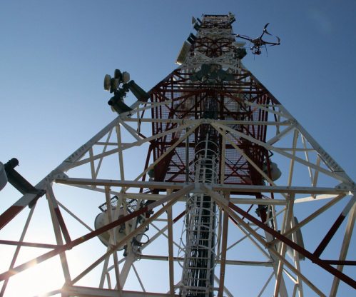
Drones are already inspecting cell towers, testing network connections, and photographing tower access routes after natural disasters. Now, AT&T wants to automate tower inspections, and at least one U.S. carrier is also looking at drones as a way to evaluate new tower sites from the sky.
Drones have the potential to revolutionize parts of the tower industry. AT&T has been using unmanned aerial vehicles to inspect towers for more than a year, and now the carrier wants to automate inspections by adding machine learning and video analytics to the mix. AT&T says that in the future, robotic drones may even be able to repair cell towers as needed.
Cameras mounted on drones can also be used to show the line of sight from the top of a cell tower or rooftop to a proposed location for a new tower. Virtual reality software can insert the shape and dimensions of the new tower so that signal paths can be better understood. A Michigan startup called Aveopt is pioneering this technology, and has already started conversations with a Tier 1 U.S. carrier. “The current methodology is such that it could take three days for a team of five to do a line of sight assessment,” said Aveopt CEO Arthur Kahn. “What they do in a day we can literally do in minutes.”
The Aveopt solution, called TerraPosition Pro, uses sensors to determine that the line of sight is clear. If it isn’t clear at first, the software moves the virtual tower to new locations to try to find a spot that works. Sites up to 10 kilometers away can be analyzed, and ground crews see images of the proposed locations on their tablets. If the location is green, they know the line of sight is clear. If it’s red, an obstruction is present.
Aveopt wants to partner with engineering firms and site acquisition specialists, and Kahn is confident that his technology will enhance revenue for these partners by increasing the number of jobs they can take on. He’s made progress with a Texas company called Surveying and Mapping, an experienced provider of drone services that is trying to win more carrier business.
“What the TerraPosition Pro does is replace a time-consuming two-step process with one accurate survey,” said Bryan Fitzpatrick, flight operations manager at Surveying and Mapping. “Software based RF analysis and field verification are no longer needed to determine line of sight. This decreases time to revenue, overall cost, and involves no tower climbing. The best part is, the exact path is ‘driven’ by the laser, leaving no doubt about line of sight.”
For now, Aveopt is not using cellular networks to connect its drones to the ground-based crews. Kahn said he hopes to use cellular at some point in the future, but for now his drones use shorter range radio technologies like Wi-Fi.
Follow me on Twitter.

