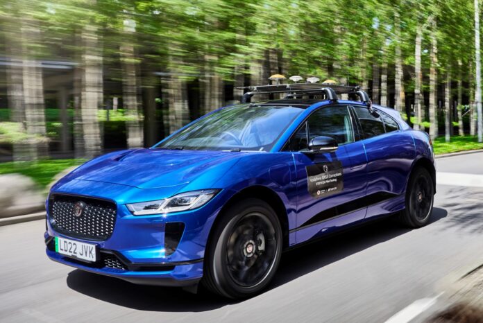
Vodafone is looking to offer enhanced satellite positioning to locate IoT devices and autonomous vehicles within centimetres, rather than with standard metre-range accuracy, as with straight GNSS services. It is working with US-based GNSS system developer Topcon Positioning Group to test the new service with “select customers” in Germany, Spain, and the UK, starting this month.
The solution, authored by Topcon, “corrects inaccuracies” in GNSS signals in the cloud, and transmits them to IoT devices, including to IoT sensors embedded into vehicles (connected and autonomous vehicles). The forthcoming trials will use IoT devices already on Vodafone’s network, including sensors, machinery, and vehicles. Vodafone cited near-term usage in its fleet telematics service.
Vodafone’s existing asset tracking and fleet telematics solutions operate in 54 countries, way beyond its 12-country network footprint. Vodafone said it will offer a “singular module configuration” that can extend across borders. It noted it “is [already] offering precise positioning” (of some form) with its Safer Transport for Europe Platform (STEP), launched in March, which allows entities to communicate beyond line-of-sight. STEP launches via Vodafone’s automotive app, plus third-party apps, later this year.
Vodafone also cited developing usage of GNSS corrections in vehicle-to-everything (V2X) technology. V2X is the carrier-backed (5G-based, invariably) technology for connected and autonomous vehicles to “speak” with one another, and with road infrastructure and systems, to enable the concept of ‘intelligent transport systems’. The pair also referenced used cases for “scooters, and even robot lawn mowers… [and e-bikes]”.
Vodafone reckons it can go “from a few metres to just centimetres” using Topcon’s “network of thousands” of GNSS reference stations – “especially when vehicles and devices are fitted with suitable antennas and receiver equipment”. The service, to be sold under the name Vodafone GNSS Corrections, will leverage both firms’ “terrestrial footprints across Europe,” they said.
A statement explained: “Topcon offers cloud-based corrections which are then sent to vehicles and devices. In turn, these enable considerable improvement of location accuracies when in open sky conditions – a scenario where the receivers on the ground are positioned away from objects such as trees to avoid obstructions or reflections from a GNSS signal.
“To provide these precise positioning accuracies, a GNSS module needs also to compensate for inaccuracies caused by satellite constellations, receiver hardware and atmospheric conditions. These inaccuracies can be calculated by Topcon’s dense network of fixed reference stations that constantly receive GNSS data.”
Justin Shields, director of platforms and solutions at Vodafone Business, said: “As new technologies like autonomous cars and connected machinery continue to evolve, Vodafone is providing the critical connections to support these new services with greater precision, more safety and at scale. Our customers want to be able to better locate their devices, and the collaboration with Topcon complements our existing asset tracking and fleet telematics solutions.”
Ian Stilgoe, vice president for emerging business at Topcon, added: “We are proud to be partnering with Vodafone to bring high accuracy correction services to enable V2X applications to operate at the accuracy needed to help improve road safety, especially for vulnerable road users… Vodafone’s high accuracy services can also be used to improve positioning performance of many other autonomous applications such as drones, delivery robots and safety system wearables.”

